Interesting

Tag: Pacific Ocean

Updated » Cyril Derreumaux has been rescued from his 4,450 km solo kayak to Hawaii

Cyril Derreumaux and his custom-made kayak named Valentine

Cyril Derreumaux and his custom-made kayak named Valentine

Updated 2021.06.11 »

After more than four days of holding in place and waiting for things to get better, Derreumeux made the difficult decision to call the U.S. Coast Guard for a rescue.

A helicopter was dispatched in the night to retrieve the ocean kayaker, who was airlifted off the water and flown back to shore. Once on land however, it didn’t take him long to start thinking about resuming the journey.

Updated 2021.06.07 »

After just a week, Cyril Derreumaux has abandoned his attempt to kayak alone to Hawaii. He set off on May 31, and although the first few days went smoothly, conditions deteriorated over the last 72 hours. He eventually called for rescue.

Derreumaux had not moved since June 4. Because of the rough weather, he deployed his sea anchor and stayed inside the cabin.

Yesterday, winds reached 55-65kph with gusts over 80kph. The waves towered to 4.5m. He also had an issue with his sea anchor but couldn’t try to fix it in such weather.

Earlier…

Rebecca McPhee for Explorersweb »

On May 31, Cyril Derreumaux dipped his paddle in the Pacific and began his 4,450km solo kayak from San Francisco to Hawaii. The 44-year-old hopes to complete the journey in 70 days.

His custom-made kayak Valentine — named after his sister –- includes an enlarged watertight aft cockpit for sleeping and storage of some of his 140 kilograms of equipment and supplies. This makes his experience quite different from the iconic paddle that Ed Gillet did in 1987, using an off-the-shelf sea kayak. Gillet, the only person to kayak from the U.S. to Hawaii, was the inspiration for Derreumaux’s project.

More »

Video » Banks Peninsula, New Zealand from Space


Note: Clicking the above image will load and play the video from YouTube.

The video of the Banks Peninsula, on the South Island of New Zealand, is presented by the European Space Agency (ESA).

Banks Peninsula, visible in the bottom-right of the image, consists of two overlapping extinct volcanoes: the Lyttelton Volcano and the Akaroa Volcano. The peninsula was formed by several volcanic eruptions that took place around eight million years ago. The name of the peninsula comes from Sir Joseph Banks, a British biologist who sailed with Captain Cook.

Breaches in the crater walls led to the formation of two long, thin harbours: Lyttelton in the north and Akaroa in the south. The peninsula also has many other smaller bays and coves, giving it its unusual, cogwheel shape. Christchurch, the largest city on South Island, is visible immediately north of Banks Peninsula.

The jagged coastline heavily contrasts with the adjoining, flat Canterbury Plains. Extending around 80 km inland from the coast to the foothills of the Southern Alps, visible in the top-left of the image, the plains are a rich agricultural region known for wheat and barley, as well as wool and livestock.

More »

Video » San Francisco Bay from Space


Note: Clicking the above image will load and play the video from YouTube.

This video from space of San Francisco Bay, California is brought to us by the European Space Agency (ESA).

San Francisco Bay, almost 100 km in length, is a shallow estuary surrounded by the San Francisco Bay Area – an extensive metropolitan region that is dominated by large cities such as San Francisco, Oakland and San Jose. The densely populated urban areas around the bay contrast strongly with the surrounding green forest and park areas.

In the upper right of the image, the delta of the Sacramento and San Joaquin rivers is visible – with the brown, sediment-filled water flowing down into San Pablo Bay. Here, the murky waters mix before flowing into the larger bay area, which is connected to the Pacific Ocean via the Golden Gate strait. A large sediment plume can be seen travelling westward into the Pacific in the left of the image.

The Golden Gate Bridge, around 2.7 km long, is visible crossing the opening of the bay into the Pacific Ocean between Marin County and the city of San Francisco – which can be seen at the tip of the southern peninsula in the centre of the image. Treasure, Angel and Alcatraz islands can be seen sticking out of the waters of the bay, with several bridges connecting its east and west shores. Several boats are also visible.

The bright green and yellow colours in the bottom right of the image are salt ponds and are part of the Don Edwards National Wildlife Refuge. Covering an area of around 120 sq km, the refuge contains salt marsh, mudflat and vernal pool habitats for millions of migratory birds and endangered species.

Read more »

Lia Ditton is getting set to row across the Pacific Ocean unassisted—and she’s afraid

Adventure Journal »

Lia Ditton is a 39-year-old licensed sea captain, yachtswoman and solo ocean rower from London. She has racked up over 150,000 miles on the sea and has taken part in some of the most grueling races on earth, such as the OSTAR transatlantic race, the Le Route du Rhum, and the Woodvale challenge. And she’s about to embark on her greatest challenge yet, rowing solo and unsupported across the Pacific Ocean. This is her story.

Three months before the Tokyo 2020 Olympics, I will depart from Choshi, Japan, on a mission to row 5,500 miles alone and unsupported, across the Pacific Ocean to the west coast of the USA. Nineteen attempts have been made to row this distance. Two were successful. Both men, both towed to land the last 20 and 50 miles respectively. One person was lost at sea.

If I succeed, I will be the first woman ever to row the North Pacific unsupported and the first person to row land-to-land [ed note: Sarah Outen rowed the North Pacific solo from Japan to the Aleutian Islands in Alaska, but with a support team, back in 2013].

Read the rest of Lia’s essay at Adventure Journal »

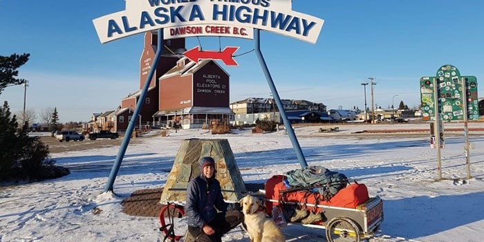
Melanie Vogel is hiking solo across Canada, from sea-to-sea-to-sea [Updated]

On June 2nd, 2017, Melanie Vogel set out to solo thru-hike the longest recreational trail in the world. Melanie’s long-distance hike started in Cape Spear, Newfoundland the most easterly point of Canada, and will lead her trough all ten Canadian provinces and two of the three territories. She originally planed to hike to Victoria on Vancouver Island in two years, but somewhere along the way decided to include the Arctic Ocean in her hike.

When Melanie is finished, she will have solo hiked 18,000 km across Canada from the Atlantic Ocean, to the Arctic Ocean, and then to the Pacific Ocean, on The Great Trail, or as some know it, the Trans Canada Trail.

Her inspirational expedition takes her through maritime terrain, boreal forests, along the Great Lakes, the Canadian prairies, the Rocky Mountains and into the tundra and permafrost as she goes north to the Arctic.

With her choice of walking this huge country, the German born and raised adventurer is embracing Canada, to better connect to the land, its people, nature and herself.

As an ambassador for The Great Trail, Melanie wants to inspire people to get outside and discover trails in their backyard and by doing so find the connection back to nature.

Melanie Vogel is the recipient of the Royal Canadian Geographical Society’s Women’s Expedition Grant for 2019.

You can follow her journey on Between Sunsets and Twitter.


Note: Clicking the above image will load and play the video from YouTube.


Note: Clicking the above image will load and play the video from YouTube.


Update 2019.12.10 » Vancouver is Awesome » This woman has been walking across Canada for 2 years and isn’t stopping yet


Update 2020.10.18 » Dan Davidson, of the Whitehorse Daily Star, writes that Melanie might spend the winter in Whitehorse as she is restricted from entering the Northwest Territories and reaching  Tuktoyaktuk and the Arctic Ocean due to the coronavirus pandemic.


© 2024 Downshift

Theme by Anders NorenUp ↑